Connecticut Shoreline Change Analysis
100 Years of Erosion and Accretion
Coastal shorelines are in a continuous state of flux due to natural processes as well as human activities. Cyclic and non-cyclic processes change the shoreline position from daily and seasonal effects (wind/waves/storms/tides), to changes in sea level over hundreds to thousands of years. Human activities changing the shoreline can range from nourishment/grading of beaches to filling, developing and armoring.
The Connecticut Shoreline Change Project analyzes how the Connecticut shoreline has changed between the late 1800’s and 2006 through loss (erosion) and gain (accretion) over time. A Geographic Information System (GIS) time series analysis was conducted using maps of the Connecticut shoreline from several different time periods between 1870 and 2006 to provide a high-level, quantifiable assessment of Connecticut shoreline trends from both a statewide and a localized perspective.
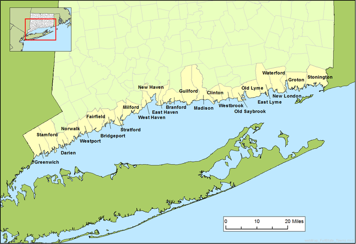
Map of Connecticut Shore with towns
The primary question asked in this analysis is, How fast has the shoreline changed?
Use the menu buttons at the top to see how we did the study and what we found.
SHORELINE TIME SERIES VIEWER: Joel Stocker, UConn Extension, has created a time series viewer for nine Connecticut sites, showing visualizations of shoreline change over time:
A UConn CLEAR webinar on the shoreline change analysis can also be found HERE
Download Shoreline Change Analysis in Connecticut full report in PDF HERE. For more information, contact Juliana Barrett or Kevin O'Brien
Download Shoreline Change Analysis in Connecticut full report in PDF HERE. For more information, contact Juliana Barrett or Kevin O'Brien
Disclaimers
Shoreline change data presented here may differ from that found in other sources. Any differences do not necessarily indicate other data sources are inaccurate. When considering other sources of shoreline change, discrepancies are to be expected considering the many possible ways of determining shoreline positions and rates of change, and the inherent uncertainty in calculating these rates. The results from this analysis represent shoreline movement under past conditions and are not intended for use in predicting future shoreline positions or future rates of shoreline change.
*Adapted and amended from Hapke, C.J., Himmelstoss, E.A., Kratzmann, M., List, J.H., and Thieler, E.R., 2010, National Assessment of Shoreline Change; historical shoreline change along the New England and Mid-Atlantic coasts: U.S. Geological Survey Open-File Report 2010-1118, 57 p.
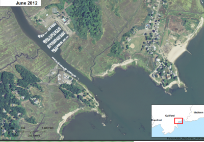
Try the SHORELINE CHANGE VIEWER to see time series images of selected coastal sites in Connecticut.